Forthcoming planned road closures and road works in Wingham - October 2023
Kent County Council Road works, Preston Hill, Wingham - from 16th October
[NB. This is an unofficial notice of these works; the official Start of Works Notice (SoWN) will follow later this month. Wingham PC]
Due to works planned to be undertaken by Kent County Council, It will be necessary to install traffic management on part of Preston Hill, Wingham, from 16th October 2023. Following these works, it will be necessary to close part of Preston Hill overnight from 8pm-5am only. Dates to be confirmed.
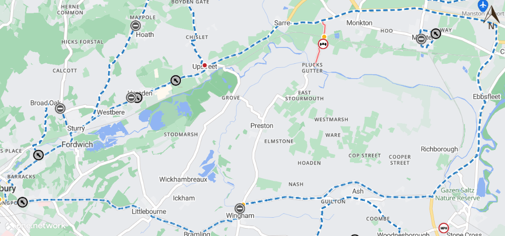
Southern Water - Temporary Road Closure - A257 High Street, Wingham - 26th October 2023 (Dover District)
Due to works planned to be undertaken by Southern Water, It will be necessary to close part of A257 High Street, Wingham, from 26th October 2023 with estimated completion by 27th October 2023.
A257 High Street, Wingham, will be closed from number 92 to number 93, between the hours of 23:00 and 06:00 only. To the extent indicated by signs and barriers on site.
The alternative route for any through traffic is via A257 Gobery Hill, A257 Roman Road, A257 Pedding Hill, A257 Ash Bypass, A256 Sandwich Bypass, A256 Ramsgate Road, A256 Richborough Way, A299 Hengist Way, A299 Canterbury Road West, A253 Canterbury Road, A253 Ramsgate Road, A28 Canterbury Road, A28 Island Road, A28 Staines Hill, A28 Island Road, A28 Mill Road, A28 Sturry Road, A28 Tourtel Road, A28 Military Road, A28 Broad Street, A28 Lower Bridge Street, A257 St George's Place, A257 Lower Chantry Lane, A257 Longport, A257 St Martin's Hill, A257 Littlebourne Road, A257 Canterbury Road, A257 The Hill, A257 High Street, A257 Wingham Road, A257 Canterbury Road and vice versa.
Pedestrian access will be maintained during the works.
The closure is required for the safety of the public and workforce while allowing water works to be carried out, works are undertaken by Southern Water.
For the most up to date information on these works please visit: https://one.network/?tm=135026107
For information regarding this closure please contact Southern Water 03303 030 368, who will be able to assist with the scope of these works.
The Kent County Council Highways Helpline phone number is: 03000 418181
Map data © MapTiler © OpenStreetMap contributors
This bulletin contains public information and can be forwarded to any other road users who may be affected. Every care is taken to ensure the accuracy of the information, but no liability can be accepted for any changes or errors.
Road names are taken from the National Street Gazetteer, which can be viewed on one.network, with alternative names given where known.
For details of roadworks, please see One.Network
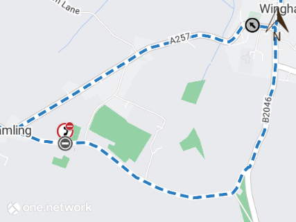
Openreach - Temporary Road Closure - Wingham Well Lane, Wingham Well - 30th October 2023 (Dover District)
Due to works planned to be undertaken by Openreach, It will be necessary to close part of Wingham Well Lane, Wingham Well, from 30th October 2023 with estimated completion by 31st October 2023.
Wingham Well Lane, Wingham Well, will be closed between the junctions of A257 Canterbury Road and Mill Road, between the hours of 09:30 and 16:00 only. To the extent indicated by signs and barriers on site.
The alternative route for any through traffic is via A257 Canterbury Road, B2046 High Street, B2046 Adisham Road, Snakes Hill and vice versa.
Pedestrian access will be maintained during the works.
The closure is required for the safety of the public and workforce while allowing utility works to be carried out, works are undertaken by Openreach.
For the most up to date information on these works please visit: https://one.network/?tm=135329645
For information regarding this closure please contact Openreach 08000 232 023, who will be able to assist with the scope of these works.
The Kent County Council Highways Helpline phone number is: 03000 418181
Map data © MapTiler © OpenStreetMap contributors
This bulletin contains public information and can be forwarded to any other road users who may be affected. Every care is taken to ensure the accuracy of the information, but no liability can be accepted for any changes or errors.
Road names are taken from the National Street Gazetteer, which can be viewed on one.network, with alternative names given where known.
For details of roadworks, please see One.Network
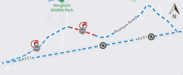
UK Power Networks - Temporary Road Closure - Rusham Road, Shatterling - 30th October 2023 (Dover District)
Due to works planned to be undertaken by UK Power Networks, It will be necessary to close part of Rusham Road, Shatterling, in 2 phases.
Phase 1 - Rusham Road will be closed, from 30th October 2023, with estimated completion by 10th November 2023, from Wingham Wildlife Park Car Park to Rosedale Kennels. To the extent indicated by signs and barriers on site.
The alternative route for any through traffic is via Rusham Road, A257 Roman Road, Beaute Lane and vice versa.
Phase 2 - Rusham Road will be closed, from 10th November 2023, with estimated completion by 19th December 2023, from Wingham Wildlife Park to A257 Gobery Hill. To the extent indicated by signs and barriers on site.
The alternative route for any through traffic is via Rusham Road, A257 Roman Road, Beaute Lane and vice versa.
Pedestrian access will be maintained during the works.
The closure is required for the safety of the public and workforce while allowing utility works to be carried out, works are undertaken by UK Power Networks.
For the most up to date information on these works please visit: https://one.network/?tm=134141443
For information regarding this closure please contact UK Power Networks 08000 294 285, who will be able to assist with the scope of these works.
The Kent County Council Highways Helpline phone number is: 03000 418181
Map data © MapTiler © OpenStreetMap contributors
This bulletin contains public information and can be forwarded to any other road users who may be affected. Every care is taken to ensure the accuracy of the information, but no liability can be accepted for any changes or errors.
Road names are taken from the National Street Gazetteer, which can be viewed on one.network, with alternative names given where known.
For details of roadworks, please see One.Network
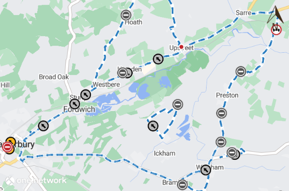
Openreach - Temporary Road Closure - Preston Road, Wingham - 31st October 2023 (Dover District)
Due to works planned to be undertaken by Openreach, It will be necessary to close part of Preston Road, Wingham, from 31st October 2023 with estimated completion by 1st November 2023.
Preston Road, Wingham, will be closed between the junctions of Preston Lane and Preston Hill, between the hours of 09:30 and 16:00 only. To the extent indicated by signs and barriers on site.
The alternative route for any through traffic is via Preston Lane, The Street, Stourmouth Road, Preston Road, The Street, Plucks Gutter, Gore Street, A253 Ramsgate Road, A28 Canterbury Road, A28 Island Road, A28 Staines Hill, A28 Island Road, A28 Mill Road, A28 Sturry Road, A28 Tourtel Road, A28 Military Road, A28 Broad Street, A28 Lower Bridge Street, A257 St George's Place, A257 Lower Chantry Lane, A257 Longport, A257 St Martin's Hill, A257 Littlebourne Road, A257 Canterbury Road, A257 The Hill, A257 The High Street, A257 Wingham Road, A257 Canterbury Road, A257 High Street, Preston Hill and vice versa.
Pedestrian access will be maintained during the works.
The closure is required for the safety of the public and workforce while allowing fibre works to be carried out, works are undertaken by Openreach.
For the most up to date information on these works please visit: https://one.network/?tm=135417495
For information regarding this closure please contact Openreach 08000 232 023, who will be able to assist with the scope of these works.
The Kent County Council Highways Helpline phone number is: 03000 418181
Map data © MapTiler © OpenStreetMap contributors
This bulletin contains public information and can be forwarded to any other road users who may be affected. Every care is taken to ensure the accuracy of the information, but no liability can be accepted for any changes or errors.
Road names are taken from the National Street Gazetteer, which can be viewed on one.network, with alternative names given where known.
For details of roadworks, please see One.Network